U of T Map+ app for iPhone and iPad
Developer: University of Toronto
First release : 28 Aug 2012
App size: 10.3 Mb
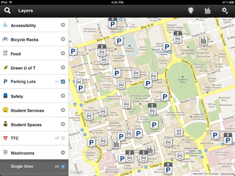
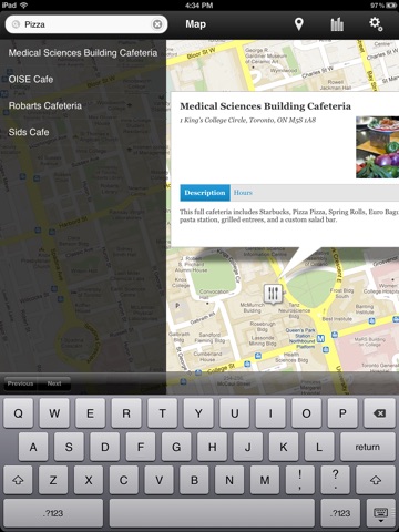
This Google-based, layered map designed for the iPad helps members of the U of T community, particularly people who are new to the campus, navigate using meaningful search words, such as "library" and "registrar". The first map layers include accessibility, food, wireless, student services (including registrars), car parking, bike racks, TTC subway stations, green sites (including green roofs and battery drop-off sites), safety, study spaces and washrooms. It is a living map, one that will develop more layers as it grows.
Version 1.0 Includes:
- Quickly find buildings and other areas of interest around campus
- Search for a specific building or amenity (such as car parking or a registrars office) easily
- Toggle between a traditional map and an annotated satellite map


